Surface Winds and Cyclonic Development
As the general circulation model for Earth drives circulation over the surface of the planet, it produces general winds for large areas. In the previous animations, high and low centers were placed generally across the surface in relation to general winds, with no explanation of how winds and pressure centers actually relate. Let's look now at how centers of high and low pressure, influenced by Coriolis forcing, produce gradients across which winds flow to develop into cyclonic and anti-cyclonic circulation.
Let's take a look at a map of sea level pressure for the afternoon of May 3, 2010 across the Pacific Northwest. What direction do you think the surface winds are over eastern Washington State?
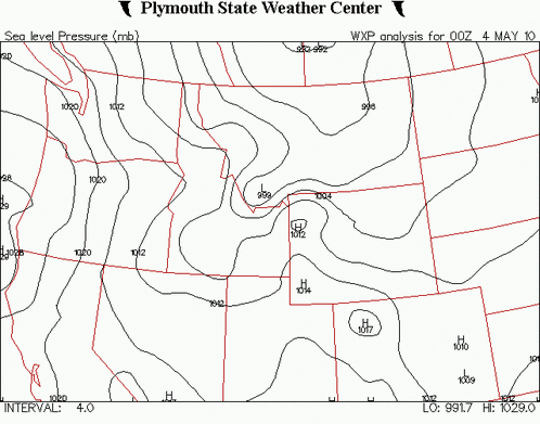
Note the high pressure located off the coast of southern Oregon and low pressure from Montana through the Canadian prairie. Isobars are plotted every 4mb. How much of a pressure difference is there between Portland, OR and Sandpoint, ID (northern Panhandle)?
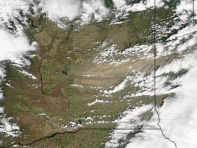
The answer should be evident from the dust plumes wafting from the drylands of eastern Washington state toward Idaho. This particular event included winds topping 59 miles per hour recorded at the Spokane airport and a number of other hazards summarized by the National Weather Service.
Log in to BBLearn, and under Module 5, go to the Study Area complete "Assignment 5.3: Cyclones and Anticyclones"
